current winds over Europe
A few posts below, there was a question in the comments asking why the cloud of depleted uranium dust from the Russian strike of the munitions depot in Khmelnytskyi would be blowing towards western Europe. The answer is that wind direction varies not only over time in any place, but also at different altitudes. Below is a map showing the current winds at 2000 feet MSL, which are blowing generally from east to west. That’s not an uncommon direction in Europe. The marker flag indicating 20 kt is located at Khmelnytskyi, Ukraine.
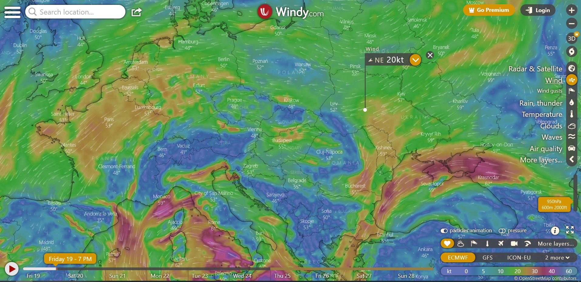
Click on the link below to display different altitudes (the slider on the lower right side) and for the forecast winds anytime through the next week (slider at the bottom), or to select various other options. The map can be moved around to check out other parts of the world and zoomed in or out. Note: FGC- you may want to light up before viewing, although I find the psychedelics come through nicely even with no enhancement 😉
HOLY MOLARS GB
THAT IS INCREDIBLE
I posted a site yesterday but not near as detailed and Damn this site knows my exact location ( top left corner)
Privacy shmivacy…
Those Ruskies are BRILLIANT…ARE THEY NOT ?
oNE DAY THE UKIES SENT LITTLE DRONES TO THE KREMLIN TO KILL PUTIN…THEN A WEEK LATER HE BLOWS UP THE WHOLE NUCLEAR AMO DEPOT AND THE WIND CARIES THE RADIATION RIGHT TO ALL THE ENEMIES.
DIABLOICALLY BRILLIANT
There’s no doubt they checked the forecast winds before doing that mission.
Looks like the radioactive cloud will pass over Germany, France then London!
Pidgeon’s coming home.
Right it’s called Karma. Western Europe’s time to glow.